PERFECT ITINERARY FOR FIRST VISIT (+ MAP & LOCAL’S TIPS)
A rich day in which you will learn about the ancient history at the walls of the city that stood on the Great Silk Road, as well as learn what connects the Hisor Valley with the Arabian Peninsula. Visit high-altitude grape plantations, and learn to play the national game “Chilikdangal”.
Tajikistan - The Republic is located at the same latitude as Greece, the southern regions of Italy and Spain, and borders China, Afghanistan, Uzbekistan and Kyrgyzstan. The territory of Tajikistan, stretching 700 km from east to west, and 350 km from north to south, is a total of 143.1 thousand square kilometers. The country is the smallest in territorial ratio among all the countries of the Central Asian region. However, this does not prevent the republic from being one of the most interesting tourist sites in the entire post-Soviet space. Tajikistan is a unique land of striking natural contrasts. For 93% Tajikistan is a mountainous country, most of which is located at an altitude of more than 3000 meters above sea level. Despite the fact that in the west of the country there are hilly desert and semi-desert areas, to the east the terrain rises, forming the highest mountain systems in Central Asia - Tien Shan and Pamir. There are more than two thousand lakes on the territory of the republic. They are mainly located in the Pamirs and in the mountains of Central Tajikistan. A traveler visiting the country, literally for a short period of time, will be able to visit all seasons and see simultaneously fruitful valleys and centuries-old cold glaciers, high-mountain plateaus with permafrost and blooming subtropics, alpine meadows, striking riot of colors, and deserts scorched by heat.
If you visit the capital of Tajikistan - the city of Dushanbe, and would like to learn a part of the history of this country, as well as to see the massive landscapes of the mountains - we have prepared for you a one-day historical and agricultural tour in the Hisor Valley. Each site below holds its own history and legends associated with different periods.
Hisor settlement used to be a historical ancient town, through which the caravans of the Great Silk Road passed. Until the 8th century it had the name “Shumon”, which means high place. At that time the whole city was surrounded by 10 kilometers of powerful wall, and the entrance was from 4 gates from different sides, it was a kind of a huge isolated fortress.
Later the territory of the valley was a part of Bactria, then Greco-Bactrian and Kushan states. This is evidenced by the remains of ancient towns and settlements discovered here by archaeologists. Today, however, only rounded mounds called “tepa” - “hill” remain. In the Middle Ages Hisor was a town known for its craftsmanship and market center. In the XVIII - XIX centuries it became Hisor bekstvo - one of the 28 possessions of the Bukhara Emirate. Since these times, the Hisor fortress has survived, which today has been turned into an open-air museum.
The role of the city of Hisor was very significant, as it was the center of the fertile Hisor valley. Any historical event in Central Asia concerned this valley, so many people wanted to conquer this city.
The Karategin Way (“Ptolemy's Way”) is one of the routes of the Great Silk Road, named in honor of Claudius Ptolemy, who described the way to the country of Serica (a country of silk-sericum suppliers). The Hisor culture (Neolithic of the mountainous regions of Central Asia) existed on these lands until the 3rd millennium B.C., the people were engaged in agriculture and cattle breeding. Hisor was one of the most famous transit towns between China and Persia, where many merchants and craftsmen stayed.
Due to the large number of foreign pilgrims, many religions, traditions, peoples and cultures spread in the city. It was a major administrative center. After a large-scale invasion of the Arabs, the city was captured and renamed, as it is called today - Hisor, which means “surrounded by a wall”, and Islam became the official religion.
Geography: Hisor is located on the western side of Tajikistan, the climate is arid and the temperature varies greatly throughout the year, with very hot summers and cold winters. Along the village and the entire Hisor district flows the large river Khanaka.
One of the most attractive tourist places in the country - Hisor Historical and Cultural Reserve is located 7 kilometers from the village. Here is located the famous Hisor fortress, mosques, madrasahs and museum. These sights are free to visit and are open daily from 8 to 18.00 (no weekends).
Tip: for the tour we advise you to wear comfortable clothes and shoes for the season, take a hat, sunglasses and phone charger, as the tour will take place during the whole day, and you will be able to make a lot of successful photos.
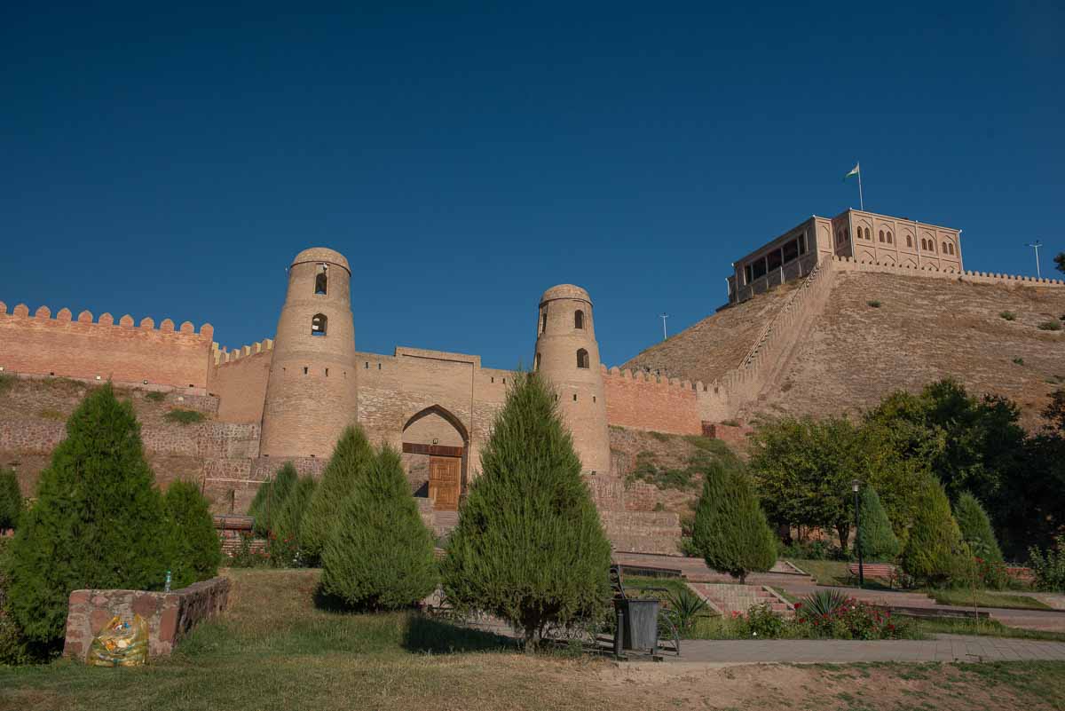
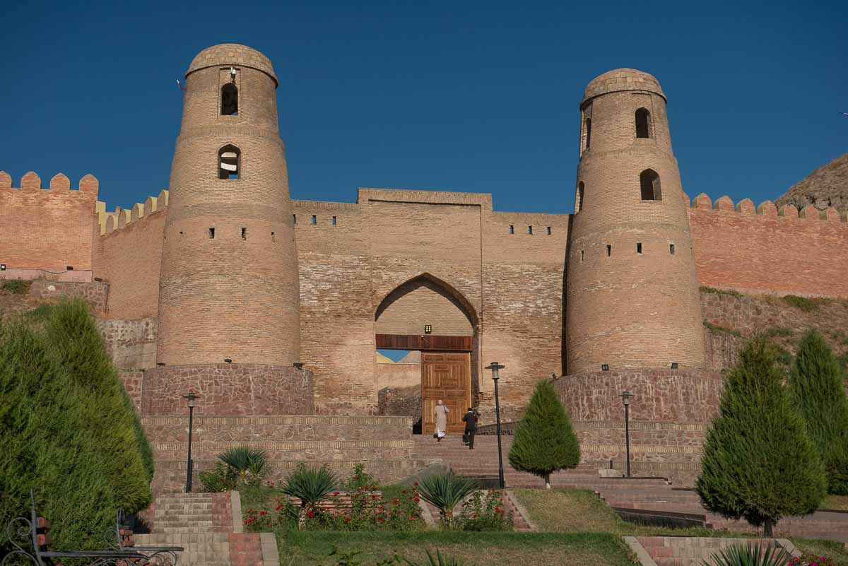
Hisor Fortress (Kal'ai Hisor) - translated from the Tajik language (kal'a - fortress; Hisor - the name of the city) - is a famous landmark of Tajikistan and one of the most popular historical monuments of Central Asia. The fortress was the residence of the bey, the viceroy of the Emir of Bukhara. The walls of the fortress were 1 meter thick, with loopholes for guns and cannons and were guarded by guards. Inside there was a swimming pool and a garden. Large stairs and terraces covered with bricks led to the main entrance. Unfortunately, they have not survived, as well as all the buildings of the palace. The only thing left from the fortress is a monumental gate made of burnt brick with two cylindrical towers, between which there is a lancet arch, as most of the gates of Bukhara of the XVIII-XIX centuries were built.
But even this fragment today looks very majestic and impressive. The towers were fully restored in 1980, and in 2010-11, before the jubilee of the city, they were reconstructed. The entrance gate of the fortress is modern, made by local craftsmen. In ancient times, opposite the fortress was a bustling market square with a caravanserai and many shops. Opposite the entrance to the fortress is the Old Madrasah of the XVII century, where the Koran was studied. Nearby is the New Madrasah XVIII-XIX cc. There is also a mausoleum of XVI-XVII centuries. A number of legends supported by local residents are connected with the Hisor fortress. According to one of them, the fortress was built by Afrosiab for protection from Rustam (the famous heroes of Firdavsi's “Shahnameh”). Another legend says that the righteous Caliph Ali came to these places on his horse Dul-dul to preach Islam and stopped on the mountain, which nowadays is called Poi-Dul-dul (west of Hisor). Under the guise of an acrobat-canalwalker he sneaked from the mountain to the fortress, but here he was recognized and captured. But his faithful horse brought him the sword of Zulfikar. With the help of this sword he exterminated all the enemies, including the evil wizard, who at that time owned the fortress. Near the fortress there are two huge chinar trees, which are about 500-700 years old.
At the moment, the fortress is about 3000 years old. You can see its impressive walls, ancient buildings and learn about the fascinating history of the city.
Currently, the fortress is undergoing restoration and construction work. On the right side of the main entrance, there is a staircase with 124 steps. The staircase leads to the Palace, which is also under construction and is scheduled to be opened by 2028.
You can climb the walls of the fortress and look around the surrounding area.
Tip: for the best photos and videos, it is better to visit the fortress before noon (12 o'clock in the afternoon) because after, the sun is at its zenith and the photos lose volume. You can also visit the fortress after 18:00, and until 19:00 to catch the beautiful glow (golden hour) and make beautiful photos in the rays of the setting sun.
Inside the fortress, you can visit the handicraft and souvenir shops. They offer traditional scarves and scarves with patterns, Pamir bracelets, handmade daggers and much more.
Tip: don't rush to make purchases in souvenir shops, in the East it is customary to haggle, so, at the beginning, walk around, study the goods, talk to the sellers. Only after that start trading. Trade in the East is not considered something shameful, and is welcomed.
|
Information: The fortress is open daily from 8 am to 5 pm every day without weekends. Entrance to the fortress for citizens of Tajikistan - 2 somoni. For foreign citizens - 10 somoni. |
Guides work daily in the reserve, so if you decide to visit Hisor on your own, they will be able to tell you in detail about the history of the fortress and the reserve and answer your questions. The guides are located at the entrance to the fortress and speak foreign languages.
Interesting fact:
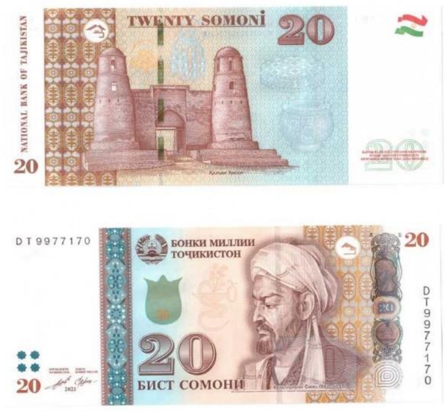
The reverse side of the 20 somoni bill depicts the gates of the Hisor fortress.
The front side depicts the medieval scientist, philosopher and physician Abu Ali ibn Sino, known in the West as Avicenna
Horseback riding
Inside the fortress there is a horse club, where those who wish can ride horses along the ancient walls of the Hisor fortress and feel the atmosphere of that time, when the only transportation was parnohoofed animals.
|
Information: The cost of one lap of horseback riding is 20 somoni. Experienced instructors will supervise the riding process. This service is available throughout the year during the working hours of the reserve (from 8 a.m. to 5 p.m.), except for days of bad weather with precipitation. |
Tip: since the territory of the fortress is earthen, in summer time, when riding horses, dust rises. We recommend that those who want to ride a horse should have a handkerchief or mask to protect their face and respiratory tract from dust.
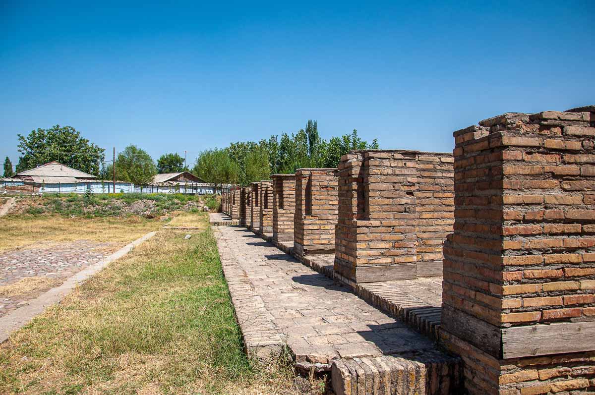
Caravanserai In ancient times, there was a market square opposite the fortress - the caravanserai (parking lot/hotel for visiting merchants). It is a large field with buildings for carts. The visiting merchants brought various goods, spices, outfits, gadgets and other things. They were loudly soliciting customers and selling their products, so there was a constant noise in front of the fortress. In the same caravan-shed the merchants stayed overnight to continue their journey the next day.
At the corner of each of the brick buildings you can notice a notch like a missing part - this special place served as a stand for oil lamps. When the wanderers slept overnight, each had his own night lamp standing on the corner.
Opposite the fortress is the Madrasai Kuhna (Old Madrasa) (a university/college for Muslim boys) - from the 17th to the 20th century it taught the holy book of Muslims - the Koran, the Arabic language and the history of Islam. Old Madrasa - was an institution of higher learning for theological education.
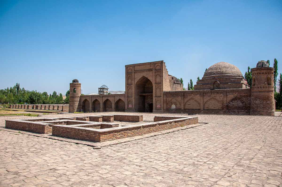
At the entrance to the madrasah a spacious rectangular courtyard opens up, all around the perimeter there are 30 hujras - small rooms of pupils where they rested. The doors to the hujras are very low in order to keep more heat in the room and for the student to bow when entering. Many traditions and teachings of Islam were performed within these walls. There were 150 boys in the madrasah, who were taken for training from the age of 14 and were mostly sons of wealthy families.
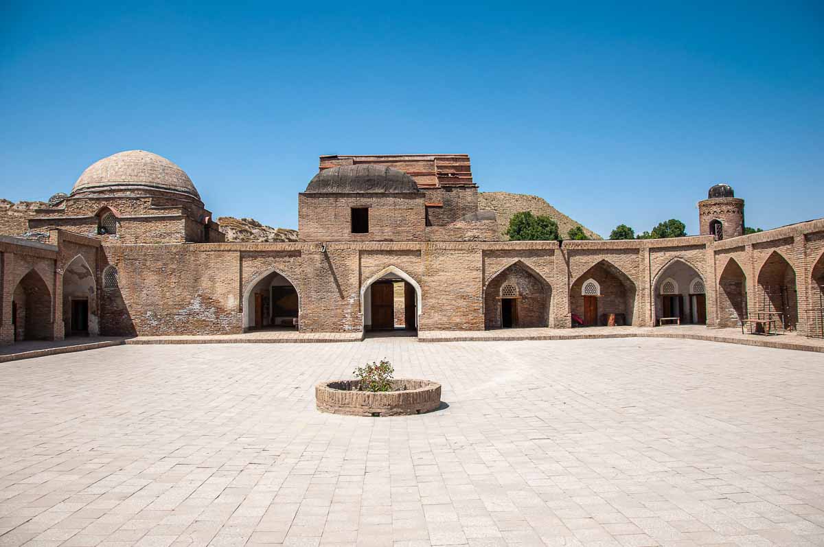
It can be seen that from the courtyard to the middle, the foundation slopes downwards, and in the middle of the courtyard there is a low round brick structure - a well.
When it rained, it served as a drain: water flowed down the slope to the very center of the courtyard and into the well. Thus, one can appreciate the experience of builders many centuries ago.
Now in the building of the theological school there is a museum with ancient exhibits (dress and everyday clothes of the early centuries, vases, archaeological finds, household items, jewelry, etc.).
You should start exploring the museum from the right side and go in a circle, each hujra has unique exhibits that give an idea of how life was in those distant years. Some rooms may be closed.
Information: Touching the exhibits and going behind the fence is prohibited. It is allowed to take photos.
|
Entrance fee: For schoolchildren citizens of Tajikistan - 1 somoni. Entrance to the museum for citizens of Tajikistan - 2 somoni. For foreign citizens - 10 somoni. |
About 150 years after its appearance, another madrasah was built nearby, which became known as the new madrasah (Madrasai Nav). So the first building got the epithet “old”. Some historians believe that in addition to these two, there was a third madrasa - a wooden one, which was built soon after Madrasa Kuhna, but it has not survived.
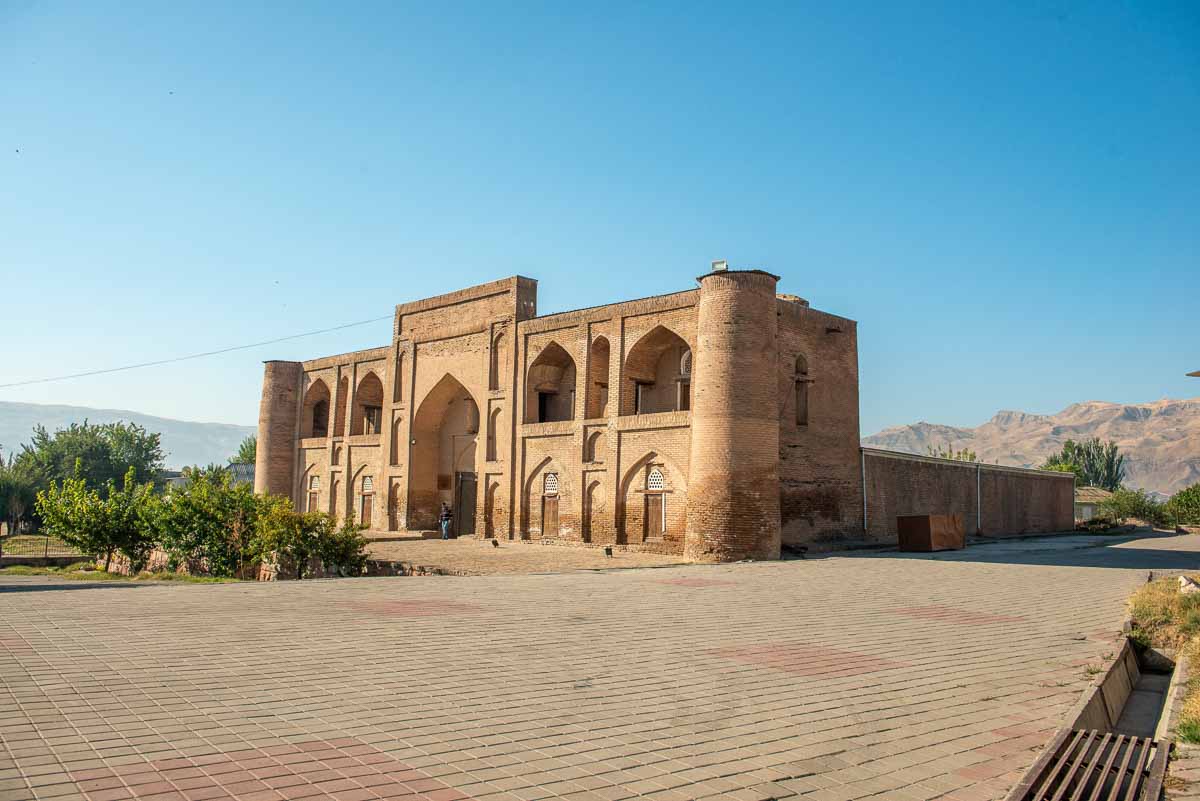
The new madrasah (Madrasai Nav) is currently closed to the public for restoration work.
Interesting fact: On the territory of the Hisor Historical and Cultural Reserve on weekends (Saturday and Sunday) there are many wedding ceremonies.
The bride in a white lush dress of European style, the groom in a classic suit, a lot of people, traditional live music and the sound of karnai and surnai (traditional wind instruments) - harbingers of the national Tajik wedding. If you visit the reserve on a weekend, there is a good chance you will catch this event.
There are also wedding photo shoots in the traditional style. The bride and groom are dressed in national outfits. The girl wears a headscarf and jewelry, and the guy wears a traditional male chapan (a coat/robe worn over clothes) and a skullcap.
The lovers are photographed within the walls of the fortress and against the background of ancient buildings, during sunset in the atmosphere of calm and silence of the mountains.
| It may be useful: anyone can have a photo session within the walls of the fortress or on a special stage, the cost of 1 shooting is 130 somoni. You can rent traditional outfits in the souvenir shops of the fortress: smart dresses, national clothes, props and so on. |
Maschidi Sangin - Stone Mosque
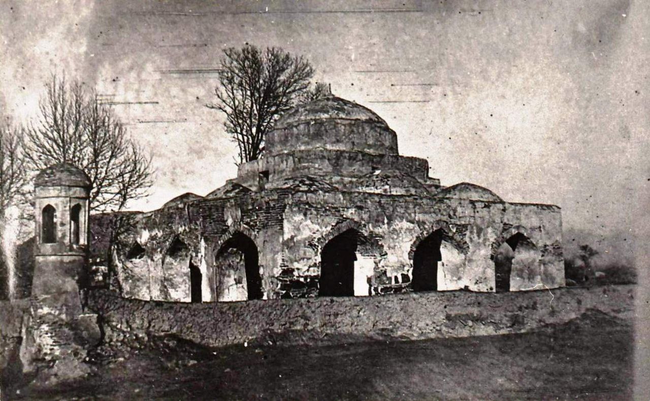
To the south-east of the Hisor fortress there is an interesting monument - Maschidi Sangin (Stone Mosque). It got its name due to the fact that the lower masonry up to half of it is made of stone blocks. The construction of the Stone Mosque was started in the XII century and continued until the XVI century. The mosque is a rectangular building with an entrance portal. Inside there is a traditional courtyard. On the entrance portal of the mosque there are skillful inscriptions and sayings from the Koran. Under the dome of the mosque 4 ceramic jugs without bottom are embedded. Thus, they turned out to be resonators designed to improve the acoustics of the room. Previously, a minaret stood next to the mosque.
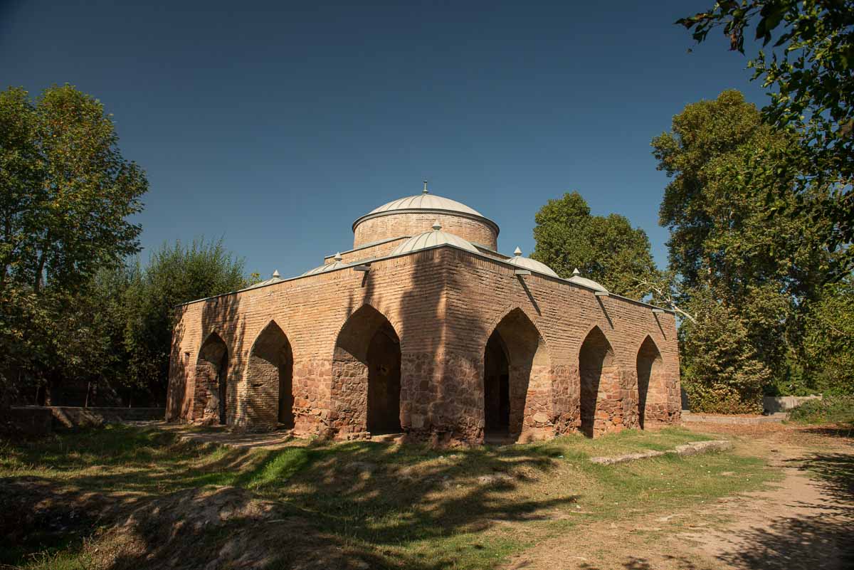
The Stone Mosque is part of the reserve, but unfortunately there is not much information about it and many tours pass it by. But this structure has its own uniqueness as it differs in its architecture from traditional mosques. On maps it is labeled as an “abandoned mosque” and many tourists and even locals do not know about its existence.
There are many opinions about the construction of this mosque. Some sources give information that its construction began in XII and was completed only in XVI century. Other sources say that it is a mosque of VII-VIII centuries, i.e. it was built before the invasion of the Arabs and its age is a little less than the age of the fortress (about 2000-2300 years).
Interesting fact: the foundation of the Stone Mosque, made of red sandstone, for which it received its name, is identical to the foundation of the New Mosque and the foundation under the two towers of the central entrance to the Hisor fortress. Perhaps this fact indicates the date of construction of the Stone Mosque.
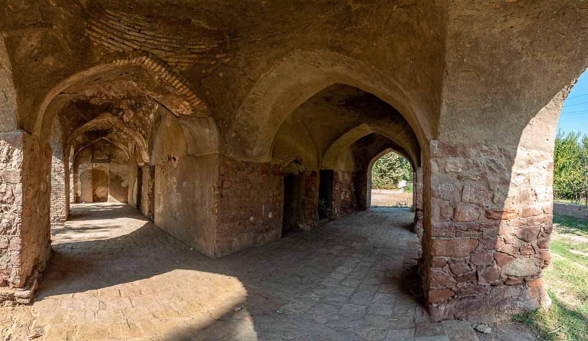
Historical photos show that at one time there was a minaret on the eastern side of the mosque, now it is gone. According to the local population, the Stone Mosque operated until the end of the 70s. After a new mosque was built, the Stone Mosque ceased to operate. In the mid 80's the mosque itself and the surrounding area were restored. Currently, the mosque is in a dilapidated state. But even in this state it attracts with its non-identity and unique architecture.
Local residents tell legends that the lower part of the building - from red stone was formed by itself, and the upper part was already completed from brick.
- “There is a legend that these stones lined up by themselves many centuries ago, no one did anything. Later it was added to and a mosque was formed,” says a local resident named Abdullafoz, who periodically improves the garden around the mosque, removes overgrowth and cleans the ditch.
Interesting fact: In this mosque was filmed a scene of the famous Soviet feature film “Dzhura - hunter from Min-Arkhar” in 1985 - a movie about the establishment of Soviet power in Central Asia in 1918-1928.
According to the management of the Hisor Historical and Cultural Reserve, the restoration of the Stone Mosque is planned in the coming years.
| Tip: do not make too loud sounds when you are in the mosque, as the walls and ceiling are very fragile. Due to sound vibrations and echoes, cracks can get bigger, leading to the complete destruction of the historic building. Be careful indoors! |
Chaikhana Kharbuza (Melon) - not included in the stops
15 minutes after leaving the Hisor reserve on the main highway you can notice a building in the form of a giant yellow melon. This unique landmark is located on the territory of the village and was built in honor of the 3000th anniversary of Hisor in 2015. The idea of the building was a restaurant of unique construction with national Tajik cuisine, but after a year it stopped functioning and since 2020 it is under repair. At the moment the building is under reconstruction and is closed to the public.
Green Wood House - not included in the stops
Recreation area located in Hisor district in a picturesque area that offers outdoor recreation, swimming in the pool and national cuisine. In summer, families from Tajikistan prefer this type of recreation outside the city - eating shashlik, swimming in the pool and sunbathing under the hot Tajik sun in various recreation areas that operate in a particular season.
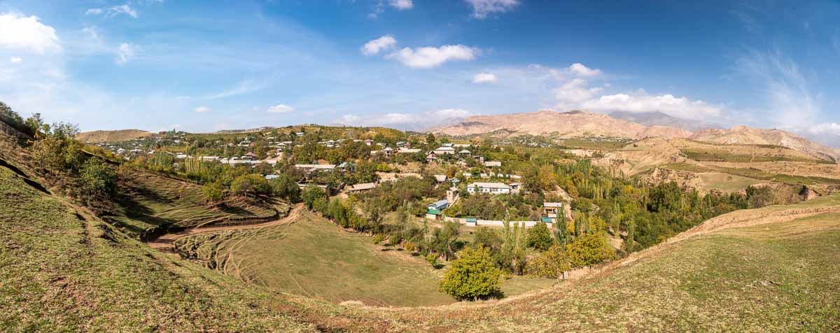
Lolazor village
Lolazor is a settlement in the Hisor district with a population of 873 people. It is famous for its picturesque nature, fertile lands and agriculture. It is on these lands that one of the most popular table grape varieties is grown - grapes of “Taifi” variety, which has a long origin.
Grapes “Taifi”
Taifi pink is a table grape variety. The variety has been known since ancient times. It was brought to Central Asia by Arabs from the Arabian port of Taef in VII-VIII centuries A.D. (there is an opinion that the name of the port is the reason for the name of this grape variety). Since ancient times, Taifi was cultivated in the vineyards of Bukhara and Samarkand, from where it spread to other regions. According to morphological and biological features it belongs to the group of oriental grape varieties.
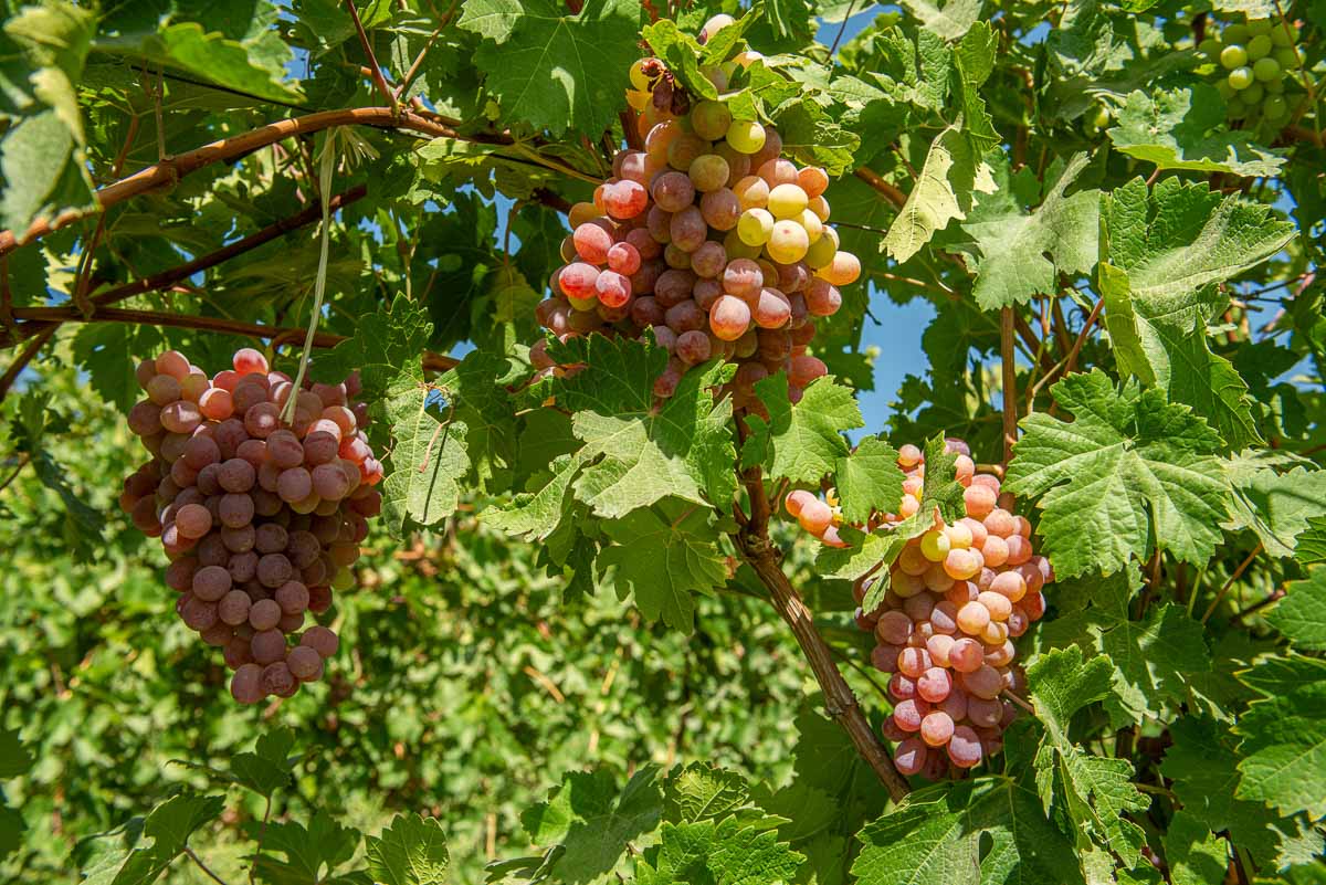
Taifi is known for its beautiful, oval-shaped berries of rich pink color and natural sweetness. This grape variety can grow in conditions of drought and heat, which is why it has settled well in the hills of the village of Lolasor.
The Taifi grape variety can be consumed fresh, dried or used to make sweet grape molasses and table vinegar.
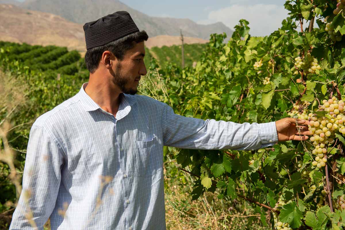
| Tip: The people of Lolazor adhere to strict religious canons, so the grapes are not made into wine and are not consumed, therefore, when visiting the village of Lolazor, do not ask the local population about the production of wine. |
Guest house in the Lolazor village
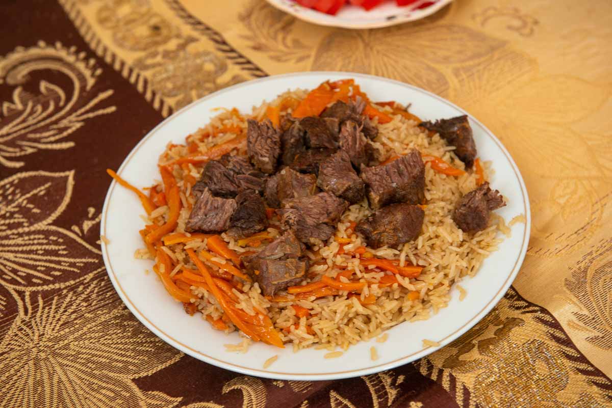
There is a private guest house in the Lolazor village. You can stay there for the night. The owner of the guest house can give a tour of his orchard, where different varieties of apples and pears are grown. You can also taste national cuisine at the guest house.
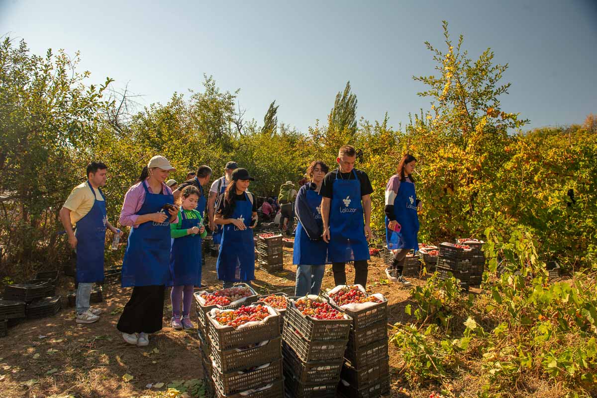
When visiting the Lolasor village, travelers should be sure to visit the grape plantations and depending on the season, you can take part in the spring work or fall harvest. Due to the high altitude location, the grapes in Lolazor are ripe by mid-October.
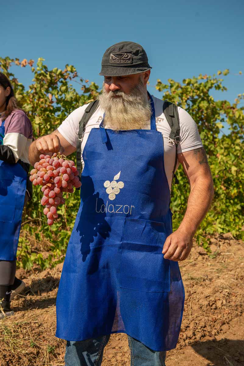
The grapes can be tasted right off the branch. Outwardly, the grapes have a light white coating on the fruit, which is a natural natural defense against parasites and bacteria, and it is even healthy for humans, so you can eat it.
Tip: Walking in the grape rows can get dirty, so choose appropriate footwear and clothing.
While participating in the grape picking, travelers are given aprons and garden shears. The leading grape grower will give a short briefing on how to properly cut a grape brush and place it in a box.
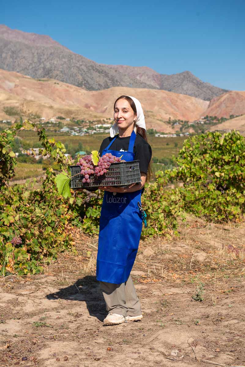
Information: there is no stable internet connection in the village of Lolazor, so be prepared to take a break from gadgets and social media and immerse yourself in village life.
The national game “Chilikdangal”
In times when people did not have TV sets and gadgets, various traditional games served as entertainment. In order to revive these games, as well as to increase their popularization, representatives of Lolazor village hold a master class on the national game “Chilikdangal” for visitors.
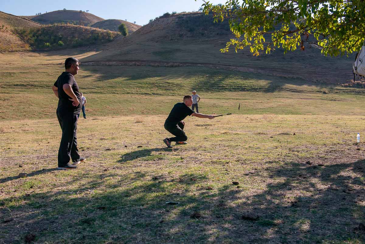
The distant relatives of this game are - baseball, lapta, etc. Two sticks are used for the game, one long 30-40 cm (dangal) and the other short 15 cm (chilik). The game is a team game, so participants are divided into two teams and after being trained in tactics and rules of the game start playing. The conditions and rules of the game may vary depending on the situation. But the basis of the game is standard. A circle is drawn, in which each member of one team, with the help of a long stick “dangal” tries to strike a short “chilik”, and throw it as far away as possible. Opponents at this time are outside the perimeter of the circle and try to catch the flying stick, if they succeed, the life of the participant of the serving team burns and the game begins another participant. If the opponents could not catch the flying stick, then from the place of falling they must try to get the stick to the center of the circle, at this time the opposing team, who are in the circle, does not let them do it, knocking the flying stick outside the line. After the stick lands, from the place where it fell, start counting the distance to the circle using a long stick. This is how points are scored.
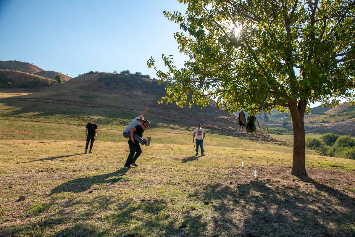
| Tip: The impact of a long stick on a short stick can be quite strong, so it is not recommended to stand in the area of the direction of impact during the game. Also, those who strike should be attentive and control the direction of the blow. Gloves should be worn to catch the short stick “chilik” as it is possible to injure your hands. |
Rural roads and villages
The return trip will pass through rural areas: Luchob and Chorbog villages, with an exit to the main Varzob highway. The roads here were built during the Soviet Union. Cows along the roads, mud houses, trees with fruit and landscapes of massive mountains are all about Tajik villages.
As you drive past villages, take note of the lifestyle of the local people - a society that is not yet fully absorbed in modern gadgets, engaged in daily chores every day. Women do housework, men and sons work in the fields, even small children have their own responsibilities.
Daily labor is the ordinary life of villagers who are busy with their farm from early morning until late at night, but they are very responsive, kind, hospitable and always welcome tourists. Simplicity of life is simplicity of soul. You may be surprised by the life and living of the local people, so that when you come back to the city, you can compare and find advantages in your current way of life, start to appreciate the freedom and opportunities you have.
Varzob gorge
Once you get on the main highway of Varzob, which leads to the city of Dushanbe, you can already notice the change of climate: the temperature in the city is higher, as the villages from which we descended are located at altitude, among the mountainous, snow-covered peaks and there is correspondingly cooler.
This intense tour offers to get out of the comfort zone and reveal the picture of life in Tajik villages, to feel the history of the ancient city and to see the beauty of one of the parts of Tajikistan - beautiful landscapes of mountains and nature beyond the city high-rises and modern sights.
How to use this map: Use your computer mouse (or fingers) to zoom in or out. Click on the icons to get more information about each place. Click the arrow on the top left corner for the index. Click the star next to the map’s title to add it to your Google Maps account. To view the saved map on your smartphone or PC, open Google Maps, click the menu and go to ‘Your Places’/’Maps’. If you want to print the map or see it in a bigger window, click on ‘View larger map’ in the top right corner.


